Wyprawa do Centralnej Argentyny - 2019 cz.2 /part two - Central Argentina Expedition
Tekst i zdjęcia - Wojciech Dąbrowski © - text and photos
|
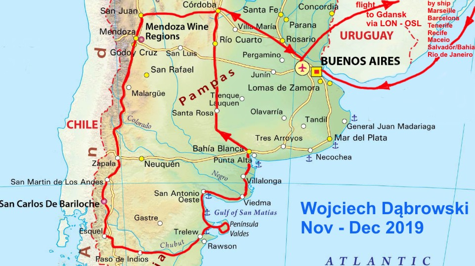
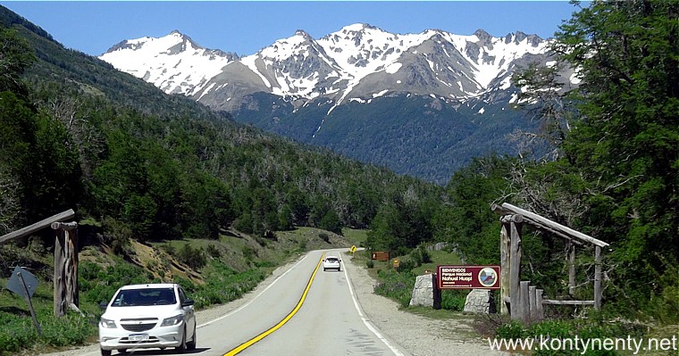
In November/December 2019 I made an interesting trip to Argentina. It consisted of two parts. To begin with, I took a cruise ship from Marseille to Buenos Aires. The second part of the journey was a car route around central Argentina, during which (with another Polish traveler - Mr. Irek) we traveled almost 5500 kilometers. Below I show chronologically selected photos from our Argentinian route. In the first part of this photo report I showed stages from Cordoba to San Martin de los Andes. Now we go further: |
W listopadzie/grudniu 2019 odbyłem ciekawą podróż do Argentyny. Składała się ona z dwóch części. Na początek statkiem popłynąłem z Marsylii do Buenos Aires. Druga część podróży to samochodowa trasa wokół Centralnej Argentyny podczas której (z innym polskim podróżnikiem - panem Irkiem) przemierzyliśmy blisko 5500 kilometrów. Poniżej pokazuję w porządku chronologicznym wybrane zdjęcia z naszej argentyńskiej trasy. W pierwszej części fotorelacji pokazałem etapy drogi od Cordoby do San Martin de los Andes. Teraz jedziemy dalej: |
|
|
|
||
|
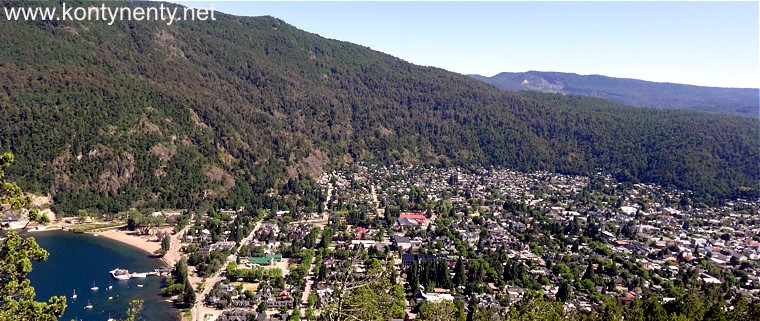
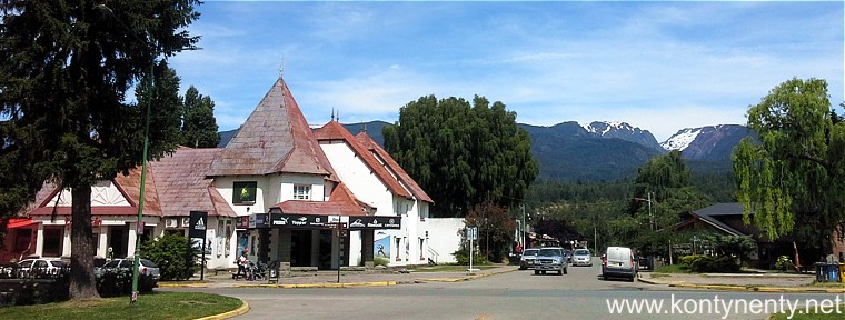
San Martin de los Andes, where this chapter begins, is a small holiday resort that has crouched on the edge of the picturesque Lacar Lake. There is a small beach here and a jetty for passenger motorboats: |
San Martin de los Andes, gdzie rozpoczyna się ten rozdział relacji, jest małą wczasową miejscowością, która przycupnęła na krańcu malowniczego jeziora Lacar. Jest tu mała plaża i przystań spacerowych statków: |
|
|
|
||
|
The town is low built. There are many private lodgings and guesthouses here, and in the main square next to the San Martin monument you can use free wi-fi. Hiking trails leading to the mountains start at the beach. |
Miasteczko jest nisko zabudowane. Wiele tu kwater prywatnych i pensjonatów, a na głównym placu obok pomnika San Martina można korzystać z bezpłatnego wi-fi. Przy plaży rozpoczynają się piesze szlaki turystyczne prowadzące w góry. |
|
 |
||
|
|
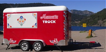
Niespodzianką był dla mnie zdobiony łowickimi motywami "food truck" stojący przy plaży. Napis "Mamusia" nie pozostawiał wątpliwości co do tego, ze to interes prowadzony przez Polaków. Niestety wczesnym rankiem instytucja była zamknięta, a ja nie mogłem czekać na otwarcie. The surprise for me was food truck decorated with Polish Lowicz motifs standing on the beach. The inscription "Mamusia" painted on it left no doubt that it was a business run by Poles. Unfortunately, the institution was closed early in the morning and I couldn't wait for the opening. |
|
 |
||
|
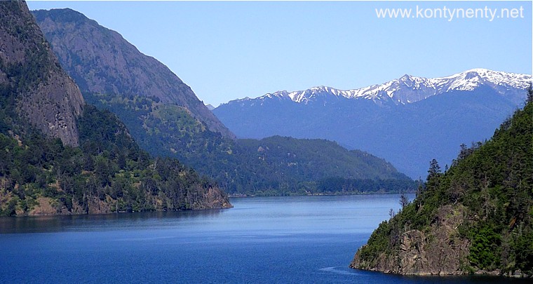
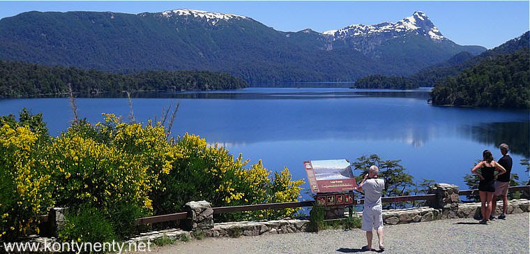
Everyone who visits San Martin should climb or dive-up to the viewpoint on the slope above the town. A great view of Lago Lacar opens from it: |
Każdy, kto odwiedza San Martin powinien wdrapać się lub wjechać na punkt widokowy na zboczu ponad miasteczkiem. Otwiera się z niego wspaniały widok na Lago Lacar: |
|
|
|
||
|
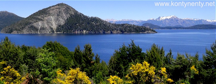
After a night spent in Sant Martin, we set off on a scenic route called Camino de los Siete Lagos - Road of the Seven Lakes. It is in fact a fragment of road No. 40 with extraordinary value. This segment is fully asphalted. You can find a map of this famous route with a description in Spanish here. |
Po nocy spędzonej w Sant Martin wyruszyliśmy dalej widokową trasą nazywaną Camino de los Siete Lagos - Droga Siedmiu Jezior. Jest to tak naprawę fragment drogi nr 40 o niezwykłych walorach. Ten odcinek jest w całości wyasfaltowany. Mapkę tej słynnej trasy wraz z opisem w języku hiszpańskim znajdziecie tutaj. |
|
 |
||
|
|
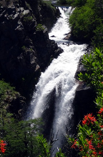
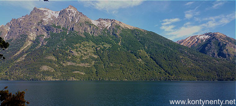
Tuż po wyjeździe z San Martin otwierają się wspaniałe panoramy (zdjęcie powyżej). Pierwsze mijane jezioro to niewielkie Lago Machonico, a wkrótce potem stajemy na punkcie widokowym, by sfotografować wodospad Cascada Vullignanco.
Just after leaving San Martin, great panoramas open (photo above). The first lake passed is a small Lago Machonico, and soon after we stand at the viewpoint to photograph the Cascada Vullignanco waterfall. |
|
|
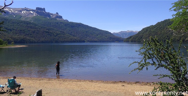
The second lake on the trail is much larger and has a beach - it's Lago Falkner: |
Drugie jezioro na szlaku jest znacznie większe i ma plażę - to Lago Falkner: |
|
|
|
||
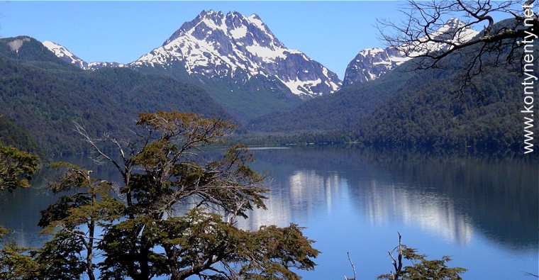
| Lago Villarino, with snow-capped peaks in the background: |
Lago Villarino, w którym przeglądają się ośnieżone szczyty: |
|
|
|
||
|
Unfortunately, not everywhere on the Seven Lakes Road convenient viewpoints were built. Sometimes visibility is limited by scrubs, but such images also have their charm: |
Niestety nie wszędzie na Drodze Siedmiu Jezior zbudowano dogodne punkty widokowe. Czasami widoczność ograniczona jest przez zarośla, ale takie obrazy też mają swój urok: |
|
|
|
||
|
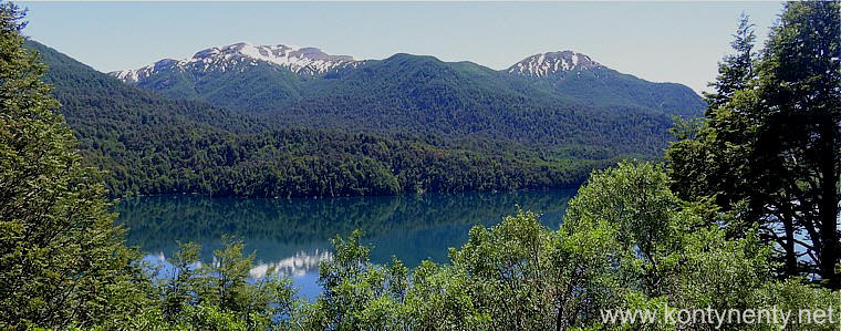
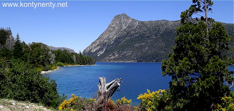
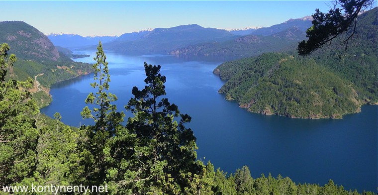
In the photo below you have the last of a series of seven lakes - Lago Espejo - certainly one of the most beautiful in the whole set. Although each of these lakes is different and it is difficult to compare them. The length of the entire "route" from San Martin to Villa la Angostura is 110 km. |
Na zdjęciu poniżej macie ostatnie z serii siedmiu jezior - Lago Espejo - na pewno jedno z piękniejszych w całym zestawie. Choć każde z tych jezior jest inne i trudno je porównywać. Długość całej "trasy" z San Martin do Villa la Angostura to 110 km. |
|
|
|
||
|
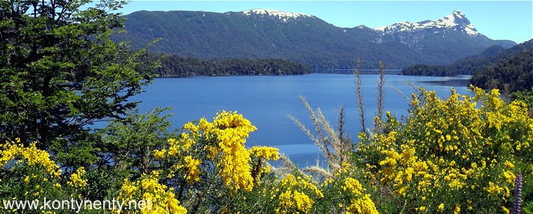
It was early summer, flowers bloomed wonderfully around (the ubiquitous yellow ones resemble Polish blazers). In addition, we were lucky with the weather - the sky was cloudless. It all made for this day wonderful! |
Było wczesne lato, wokół wspaniale kwitły kwiaty (te wszechobecne żółte przypominają polskie żarnowce). W dodatku mieliśmy szczęście do pogody - niebo było bezchmurne. To wszystko złożyło się na ten wspaniały dzień! |
|
|
|
||
|
Finally, we enterted the international road running from the border crossing with Chile and I saw again Lake Angostura - one of the largest lakes of the region. In fact, it was the eighth lake on our day route. I watched this lake already once, years ago, traveling by bus from Chile to Bariloche: |
Wreszcie wyjechaliśmy na międzynarodową drogę biegnącą od przejścia granicznego z Chile i zobaczyłem ponownie Jezioro Angostura - jedno z największych jezior tego regionu. Tak naprawdę, to było ono już ósmym jeziorem na naszej dziennej trasie. Oglądałem je już kiedyś przed laty, jadąc autobusem z Chile do Bariloche: |
|
|
|
||
|
At that time, however, I couldn't stop to fully appreciate and photograph these magnificent views. Such opportunities you can have only when driving a rented car. There are many places on the lake shore where you can stop for a picnic. There are also small beaches, few tourists are seen: |
Wtedy jednak nie mogłem się zatrzymać, aby docenić w pełni i sfotografować te wspaniałe widoki, takie możliwości dale tylko jazda wypożyczonym samochodem. Nad jeziorem jest wiele miejsc, gdzie można zatrzymać się na piknik. Są także małe plaże, turystów widzi się mało: |
|
|
|
||
|
Theoretically, the scenic Road of the Seven Lakes ended, but heading further to Bariloche, we still rode along the shores of the long Lake Angostura, enjoying our eyes with another great views: |
Teoretycznie widokowa Droga Siedmiu Jezior się skończyła, ale kierując się dalej do Bariloche my wciąż jechaliśmy brzegiem długiego Jeziora Angostura ciesząc oczy kolejnymi wspaniałymi widokami: |
|
|
|
||
|
The is a reason why I have called this part of my site "postcards from Argentina". Many of these views can certainly be a material for postcards, don't you think so? |
Nie bez powodu nazwałem tę część mojego serwisu pocztówkami z Argentyny. Wiele z tych widoków na pewno może być materiałem na pocztówki: |
|
|
|
||
|
Somewhere at the end of Lake Angostura is a tiny bay. On its other side a steep, jagged mountain rise up into the sky. This place is called Paso Coihue and it is definitely worth to stop here to admire the beauty of Andean nature: |
Gdzieś na końcu Jeziora Angostura jest maleńka zatoka. Po jej drugiej stronie wystrzela w niebo stroma, poszarpana góra. To miejsce nazywa się Paso Coihue i na pewno warto tu stanąć, by podziwiać piękno andyjskiej przyrody: |
|
 |
||
|
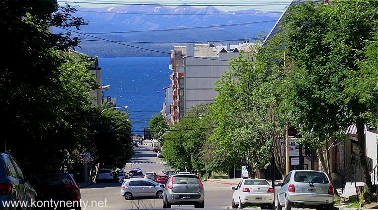
The road number 40 arches wide around the end of the next lake - Nahuel Huapi, eventually leading to the 100,000-plus inhabitants holiday town of San Carlos de Bariloche. The streets converge here steeply to the lake: |
Droga numer 40 szerokim łukiem okrąża koniec następnego jeziora - Nahuel Huapi doprowadzając w końcu do 100-tysięcznego wczasowego miasteczka San Carlos de Bariloche. Ulice zbiegają tu stromo do jeziora: |
|
|
|
||
|
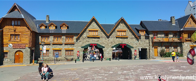
Numerous stone buildings resemble the architecture of tourist resorts in the Alps: |
Liczne budowle wzniesione z kamienia przypominają architekturą turystyczne miejscowości w Alpach: |
|
 |
||
|
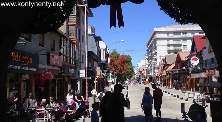
The main street of Bariloche, partly converted into a pedestrian zone, is filled with cafes and shops - in many of them you can buy locally produced chocolates. Bariloche is called the Argentine chocolate capital... |
Główna ulica Bariloche, częściowo zamieniona na deptak wypełniona jest kawiarniami i sklepami - w wielu spośród nich można kupić produkowane na miejscu czekoladki. Bariloche nazywane jest argentyńską stolicą czekolady... |
|
|
|
||
|
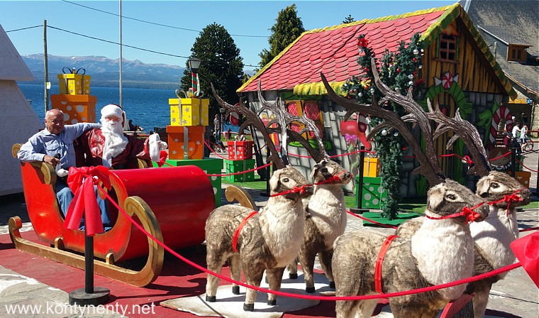
Time was pre-Christmas, so in the square in front of the stone town hall waited for those willing to take a photo of Santa Claus in a sleigh. I sent this pic to my friends... :) |
Czas był przedświąteczny, więc na placu przed kamiennym ratuszem czekał na chętnych do zrobienia okolicznościowej fotografii Mikołaj w saniach. Skorzystałem... :) |
|
|
|
||
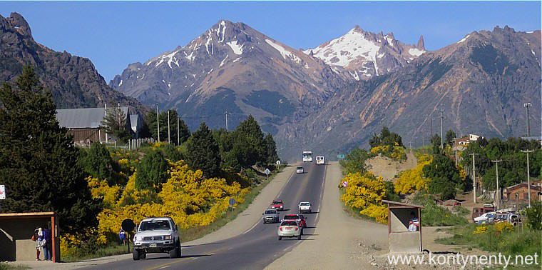
| The next morning in fine weather we were leaving the city to the south. Neglected suburb buildings did not deserve attention, but it is difficult not to stop, having in the perspective of the road such magnificent peaks as in the photo below. This is Cerro Catedral: |
Następnego dnia rano przy świetnej pogodzie wyjeżdżaliśmy z miasta w kierunku południowym. Zaniedbana zabudowa przedmieść nie zasługiwała na uwagę, ale trudno nie przystanąć, mając w perspektywie drogi takie wspaniałe szczyty jak na zdjęciu poniżej. To Cerro Catedral: |
|
 |
||
|
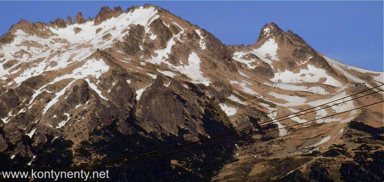
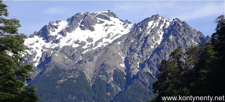
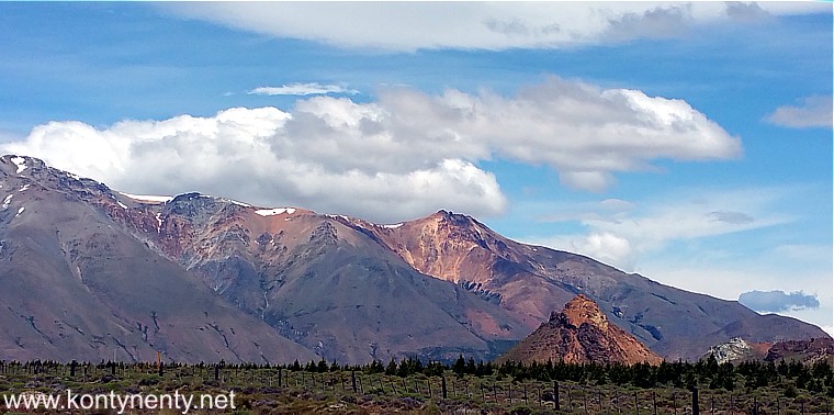
Cerro Catedral is rising to 2100 m above sea level. It was a South American summer, but there were still lots of snow on the upper slopes: |
Cerro Catedral ma wysokość 2100 m npm. To było południowoamerykańskie lato, ale na górnych stokach wciąż leżało wiele płatów śniegu: |
|
|
|
||
|
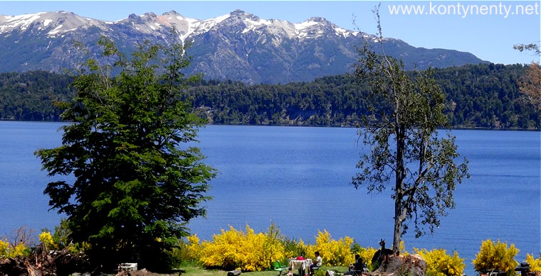
And although the Road of the Seven Lakes has long ended, today we also had the opportunity to admire the next Andes mountain lakes - in the photo below Lago Gutierrez: |
I choć Droga Siedmiu Jezior się już dawno się skończyła dziś też mieliśmy okazje podziwiać kolejne górskie jeziora Andów - na zdjęciu poniżej Lago Gutierrez: |
|
 |
||
|
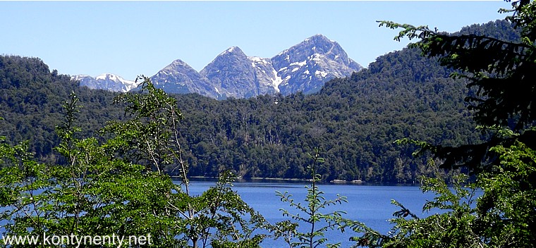
These magnificent peaks can compete with their beauty not only with the Alps, but also with the Himalayas. Only that a very limited group of travelers knows about their existence. And those who would like to come here are discouraged by high prices of flights from Europe. |
Te wspaniałe szczyty mogą śmiało konkurować swoją urodą nie tylko z Alpami, ale i z Himalajami. Tyle tylko że o ich istnieniu wie bardzo ograniczone grono podróżników. A tych, którzy chcieliby tu przyjechać odstraszają wysokie ceny przelotów z Europy. |
|
 |
||
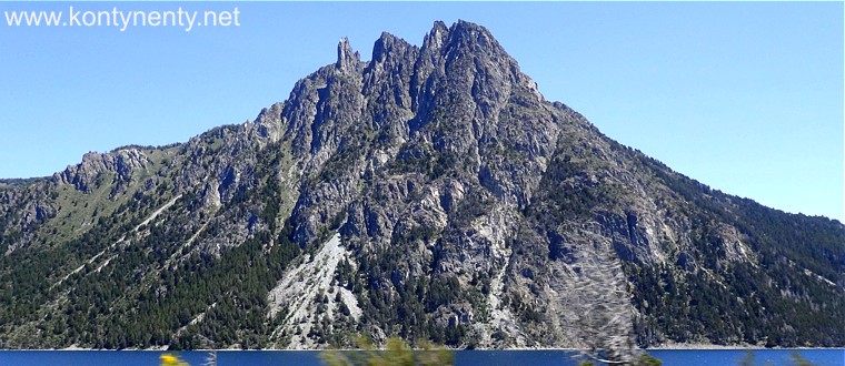
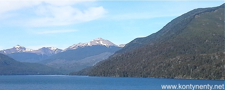
| The next lake we passed was Lago Mascardi (pictured below). The road, running along the shores of the lake, changed direction to the south-east. The snowy peaks of the main Andes range are somewhere behind ... |
Następnym jeziorem które mijaliśmy było Lago Mascardi (na zdjęciu poniżej). Szosa, biegnąc wzdłuż brzegów jeziora zmieniła kierunek na południowo - wschodni. Ośnieżone szczyty głównego pasma Andów pozostały gdzieś w tyle... |
|
 |
||
|
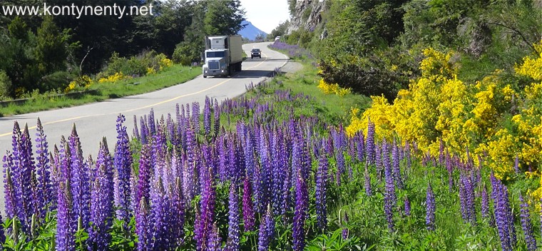
But it was still the famous road No. 40. In this photo, in addition to these ubiquitous yellow flowers, you can also see well-known lupins. They grow here in the wild not only on the roads, but also in the meadows. They come in several colors. True, how beautiful it looks like! |
Ale to wciąż była ta słynna droga nr 40. Na tym zdjęciu poza tymi wszechobecnymi żółtymi kwiatami widać także znane nam doskonale łubiny. Rosną tu one na dziko nie tylko przy drogach, ale także na łąkach. Występują przy tym w kilku kolorach. Prawda, jak pięknie to wygląda? |
|
 |
||
|
|
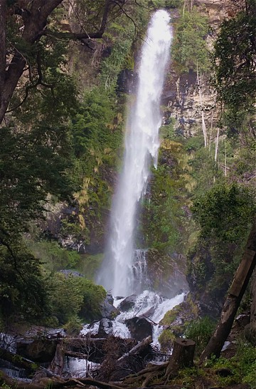
Kilka kilometrów dalej znaki drogowe obwieściły wodospad Cascada de la Virgen. Wodospad widoczny jest z szosy, ale aby mu się przyjrzeć trzeba przejść kilkaset metrów do jego podnóża. Znajdziecie tam dwie ścieżki biegnące w górę po obu stronach potoku wypływającego spod wodospadu. Lewa ścieka kończy się na zwalonym mostku. Lepiej iść prawą ścieżką - obok kapliczek - wtedy można zrobić takie zdjęcie jak obok. Wodospad ma jakieś 40 metrów wysokości.
Few kilometers away, road signs announced the Cascada de la Virgen waterfall. The waterfall is visible from the road, but to look at it you need to walk several hundred meters by foot. There you will find two paths running upwards on both sides of the stream flowing out from under the waterfall. The left trickle ends on a fallen bridge. It is better to follow the right path - next to the shrines - then you can take a photo like the the one on the left column. The waterfall is about 40 meters high.
|
|
 |
||
|
20 km from the waterfall lies the tiny town of El Bolson in the valley. It used to be a favorite oasis of hippies. Today it is a starting point for excursions to the surrounding mountains. |
20 km od wodospadu leży w dolinie maleńkie miasteczko El Bolson. Kiedyś była to ulubiona oaza hippisów. Dziś jest bazą wypadowa dla wycieczek w okoliczne góry.
|
|
 |
||
|
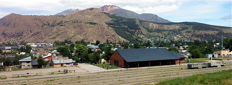
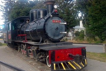
Road No. 40 led us shortly after to the city of Esquel, where we could rest in a cheap ($ 10 per room) and a completely empty hostel. There was once a last narrow-gauge railway station leading from the foothills of the Andes towards the coast. The line opened in 1940 is no longer open today. The station (photo below) is abandoned: |
Droga nr 40 doprowadziła nas wkrótce potem do miasta Esquel, gdzie mogliśmy odpocząć w tanim (10 dolarów za pokój) i zupełnie pustym hostelu. W miasteczku była kiedyś końcowa stacja kolei wąskotorowej prowadzącej od podnóża Andów w kierunku wybrzeża. Otwarta w roku 1940 linia dziś nie jest już czynna. Stacja (zdjęcie poniżej) jest opuszczona: |
|
|
|
||
|
|
Ale parowa lokomotywa "La Trochita" raz w tygodniu ciągnie krótki skład starych wagonów z turystami na odcinku kilkunastu kilometrów. Turystyczna trasa zaczyna się jednak za miastem.
But the steam locomotion "La Trochita" once a week pulls a short train of old carriages with tourists over a distance of several kilometers. However, the tourist route starts outside the city. |
|
|
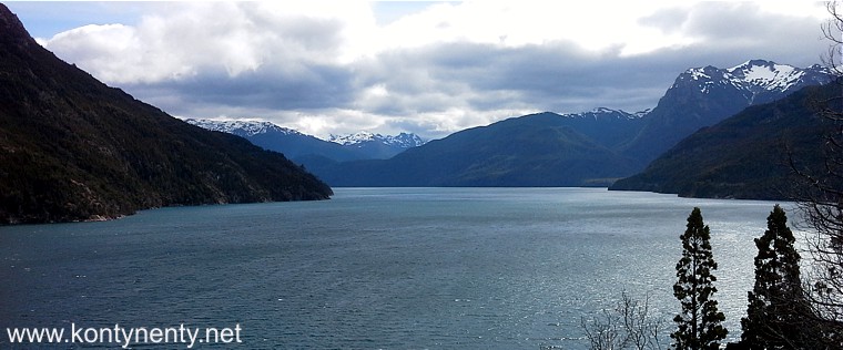
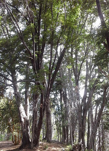
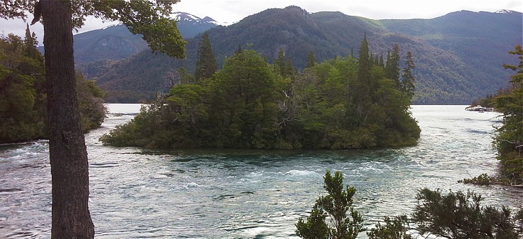
Before we set off on our journey, we were able to spend half a day on a trip by car to the nearby National Park Los Alerces. The park is famous for its old, endemic alerces trees, but its landscape is dominated by lakes surrounded by forested mountains: |
Zanim wyruszyliśmy w dalszą drogę udało się nam wygospodarować pół dnia na wycieczkę samochodem do pobliskiego Parku Narodowego Los Alerces. Park słynie ze starych, endemicznych drzew alerces, ale w jego krajobrazie dominują jeziora otoczone zalesionymi górami: |
|
|
|
||
|
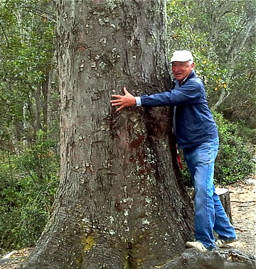
Drzewa jak drzewa - rosną wysokie, a niektóre tak grube, że nie można ich objąć. Ale okazało się, ze do tego najstarszego - o średnicy 2.20 m i wysokości 57 m (ma podobno 2600 lat) można dopłynąć tylko stateczkiem odpływającym tylko raz dziennie - przed południem... |
|
|
|
Trees like trees - they grow tall, and some so thick that they can not be embraced. But it turned out that the oldest one - with a diameter of 2.20 m and a height of 57 m (supposedly 2600 years old) can be reached only by a boat leaving only once a day - before noon ... |
Na terenie parku narodowego poprowadzonych jest wiele kilometrów pieszych szlaków turystycznych, ale wydaje mi się, że najpiękniejsze panoramy fotografować można tam, gdzie góry spotykają się z wodami jezior. Niestety tego popołudnia w krajobrazie zabrakło nam słońca: |
|
|
|
||
|
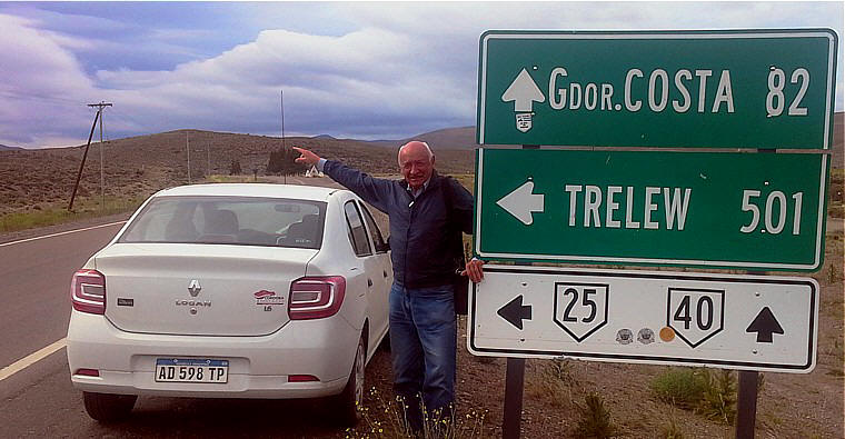
The next morning we refueled our car "to full" before a difficult stage. Already several dozen kilometers south of Esquel in Tecka we were to say goodbye to our picturesque route No. 40 and head east - to the Atlantic via Route No. 25. I read a lot about the poor quality of this road running through the wasteland. There were over 500 kilometers from the turnout in Tecka to the nearest town: |
Następnego poranka zatankowaliśmy paliwo "do full" przed trudnym etapem. Już kilkadziesiąt kilometrów na południe od Esquel w miejscowości Tecka mieliśmy pożegnać naszą malowniczą drogę nr 40 i skierować się na wschód - ku Atlantykowi drogą nr 25. O złej jakości tej drogi biegnącej przez pustkowia naczytałem się dużo w internecie. To miała być trasa pełna dziur, na której nie można rozwinąć większej szybkości. Od rozjazdu w Tecka do najbliższego miasteczka było ponad 500 kilometrów: |
|
|
|
||
|
|
||
 |
Ale o tym kolejnym odcinku naszej
podróży napisałem już na kolejnej stronie...
But about this episode of our journey I have already written on the next page ... |
|
|
To the third part of my report from Argentina
|
Przejście
do trzeciej części relacji z Argentyny
|
|
Przejście do strony "Moje podróże" Back to main travel page
Powrót do głównego katalogu Back to the main directory
![]()