Samotnie do Ameryki Południowej - Solo to South America
|
|
Tekst i zdjęcia - Wojciech Dąbrowski © - text and photos
|
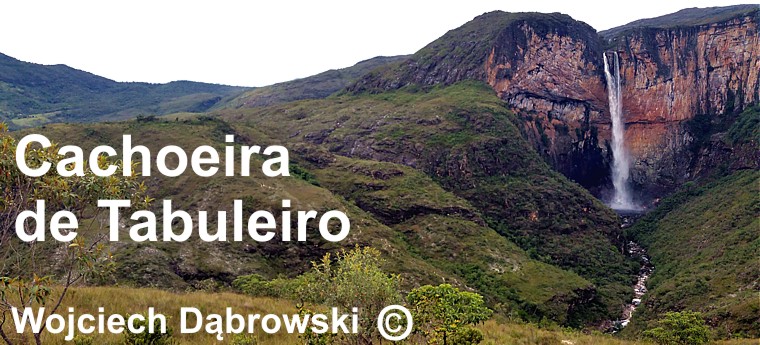
In 2018 I went on a lonely trip to Estrada Real - the Brazilian Royal Way. Heading from Belo Horizonte to the north end of this route, I decided to use the opportunity to reach the third highest waterfall in Brazil. It has a height of 273 meters. It lies in the state of Minas Gerais, in the central part of the country, near the town of Conceição do Mato Dentro. I have not heard before that a Polish traveler would watch him. |
W roku 2018 wybrałem się na samotną wędrówkę po Estrada Real - brazylijskiej Królewskiej Drodze. Zmierzając z Belo Horizonte na północny kraniec tej trasy postanowiłem wykorzystać okazję, by dotrzeć do trzeciego pod względem wysokości wodospadu Brazylii. Ma on wysokość 273 metry. Leży on w stanie Minas Gerais, w centralnej części kraju, w pobliżu miasteczka Conceição do Mato Dentro. Nie słyszałem wcześniej, aby oglądał go jakiś polski podróżnik. |
|
|
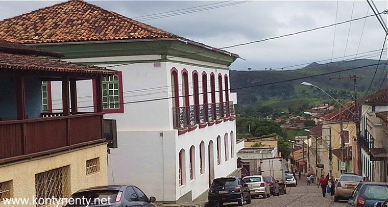
Conceição do Mato Dentro from the nearest major city / airport - Belo Horizonte can be reached by bus or rented car. It's about 180 kilometers. Conceição itself lies on the Royal Way. It has a small historic district, which you can get around in two hours: |
Do Conceição do Mato Dentro z najbliższego dużego miasta/lotniska - Belo Horizonte można dojechać autobusem lub wynajętym samochodem. To około 180 kilometrów. Samo Conceição leży na Królewskiej Drodze. Ma niewielką zabytkową dzielnicę, którą mozna obejść w ciągu dwóch godzin: |
|
 |
||
|
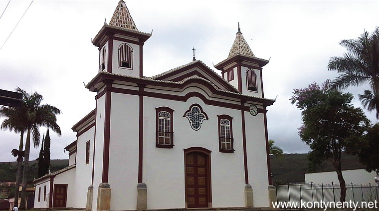
The most interesting monument is the Matriz church (pictured below), the church has been recently renovated and is said to have very rich interior. Unfortunately, I could not see him because the church was closed: |
Najciekawszym zabytkiem jest tu kościół Matriz (na zdjęciu poniżej) kościół został niedawno odnowiony i ma podobno bardzo bogate wyposażenie. Niestety nie mogłem go zobaczyć, bo kościół zastałem zamknięty: |
|
|
|
||
|
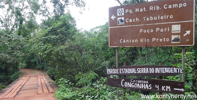
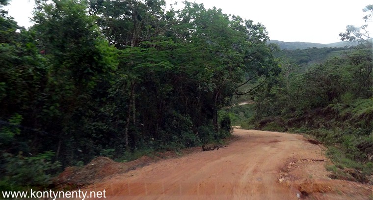
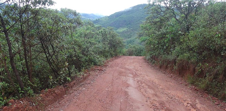
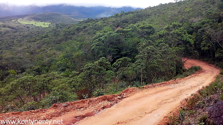
From Conceição to the village Tabuleiro near the waterfall it is still 21 kms of country road. The province of Conceicao do Mato Dentro has 2000 kms of red, muddy, bumpy roads sneaking up and down green, rolling hills. It is undiscovered paradise for 4WD lovers. Those roads are crossing streams and rivers, they lead to the view points and great waterfalls: |
Z Conceição do osady Tabuleiro w pobliżu wodospadu jest wciąż 21 kilometrów jazdy terenową drogą bez nawierzchni. Prowincja Conceição ma 2000 kilometrów takich czerwonych, błotnistych i wyboistych dróg. To nie odkryty jeszcze raj dla offroadowych kierowców. Takie drogi przecinają tu stłumienie i rzeki prowadza tu do punktów widokowych i wspaniałych wodospadów: |
|
 |
||
|
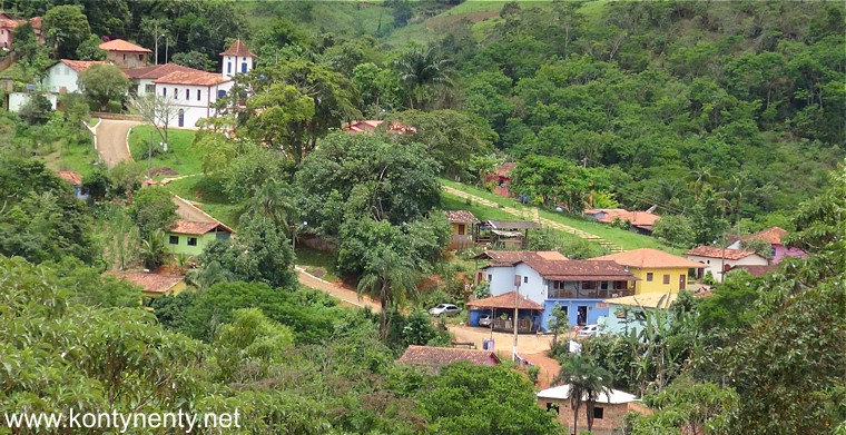
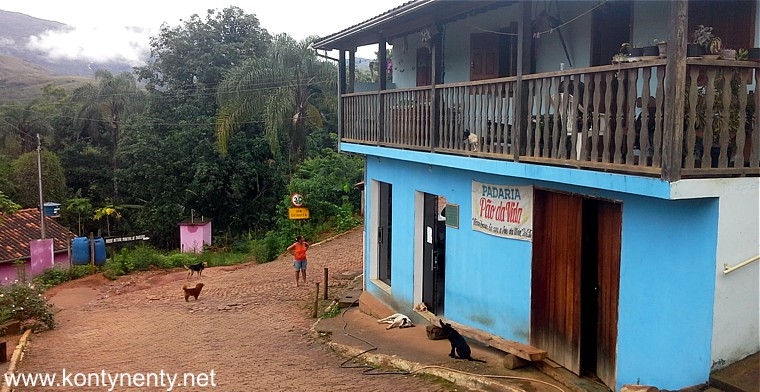
Public transport (bus) on the route to Tabuleiro operates only on Mondays, Wednesdays and Fridays. The bus leaves at 8.00 from Tabuleiro and at 14.00 from Conceição. The ticket costs 15 reales. Taxi on this route - about 80 reales. On Thursdays this bus is doing a similar course on the LMG 739 route - look at the map. In the picture below I showed the settlement of Tabuleiro, which is the only base for trips to the waterfall. In the upper part of the settlement there is a small church and residential houses. Colorful houses at the bottom of the settlement house guesthouses, shops and a restaurant for tourists: |
Publiczny transport (autobus) na trasie do Tabuleiro funkcjonuje tylko w poniedziałki, środy i piątki. Autobus odjeżdża o 8.00 z Tabuleiro i o 14.00 z Conceição. Bilet kosztuje 15 reali. Taksówka na tej trasie - około 80 reali. W czwartki ten autobus robi podobny kurs po trasie LMG 739 - popatrzcie na mapkę. Na zdjęciu poniżej pokazałem osadę Tabuleiro, która jest jedyną bazą dla wycieczek do wodospadu. W górnej części osady jest mały kościółek i domy mieszkalne. Kolorowe domki w dolnej części osady mieszczą pensjonaty, sklepiki i restauracyjkę dla turystów: |
|
|
|
||
|
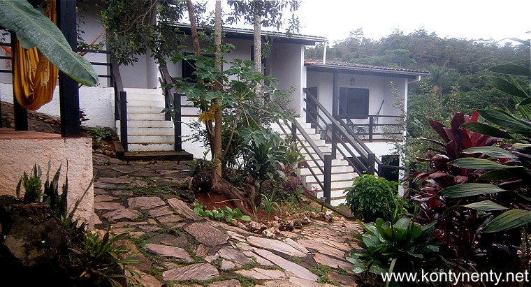
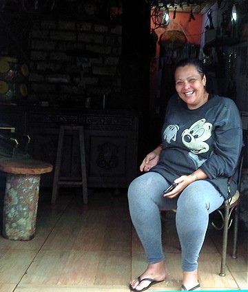
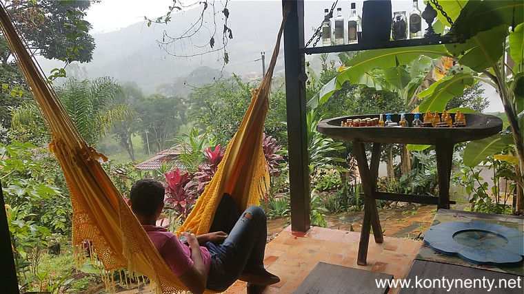
In this settlement I found (through booking.com) accommodation in a small hotel Villa Tabuleiro. I would rather describe this object with the word "lodge". For a small room with bathroom, fan and breakfast, I paid here 100 reais. Good wi-fi connection and hammock on the balcony were also included: |
W tej osadzie znalazłem (przez booking.com) zakwaterowanie w niewielkim pensjonacie Villa Tabuleiro. Ja bym raczej określił ten obiekt słowem "lodge". Za pokoik z łazienką, wiatrakiem i śniadaniem płaciłem tu 100 reali. Dobre połączenie wi-fi i hamak na balkonie były także wliczone: |
|
|
|
||
|
Villa Tabuleiro's pavilions stand on the hillside in a tropical garden, where papayas, bananas grow and hibiscus bloom. In December, when I was there, there were no mosquitoes, which are an inseparable attribute of the tropics, perhaps because Tabuleiro lies about 600 m above sea level. There are no glass in the windows, you will close shutters at night. |
Pawilony Villi Tabuleiro stoją na zboczu wzgórza w tropikalnym ogrodzie, gdzie rosną papaje, bananowce i kwitną hibiskusy. W grudniu, gdy tam byłem nie było wcale komarów, które są nieodłącznym atrybutem tropiku, być może dlatego, że Tabuleiro leży około 600 m nad poziomem morza. W oknach nie ma tu szyb, na noc zamyka się żaluzjowe okiennice. |
|
 |
||
|
|
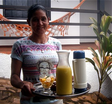
Byłem jedynym gościem. Codziennie rano na tarasie Villa Tabuleiro serwowano solidne śniadanie: sok produkowany na miejscu, czarną jak smoła kawę, owoce, zapiekankę z sera i szynki i serowe kuliste bułeczki...
I was the only guest in Villa. Every morning, a solid breakfast was served on the Villa Tabuleiro terrace: juice produced on site, pitch-black coffee, fruit, cheese bread balls and ham and cheese burgers... |
|
|
|
||
|
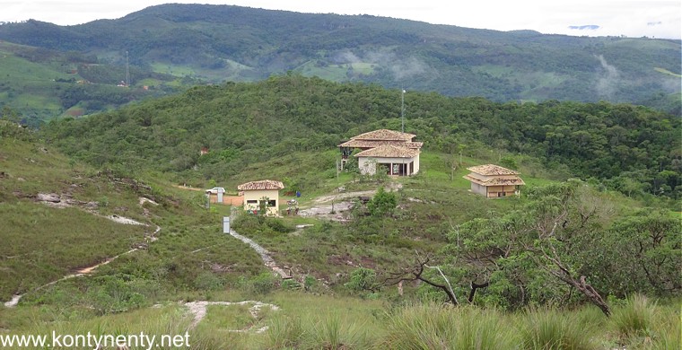
My host Ricardo gifted me a tourist map of the area. It is very difficult to get something like that here. I scanned her and placed it here so that everyone could download it and print it - it's much easier to plan a stay and excursions with something like that. |
Mój gospodarz Ricardo podarował mi turystyczną mapkę terenu. Bardzo trudno coś takiego tu zdobyć. Zeskanowałem ją i umieściłem tutaj, aby każdy mógł ją sobie pobrać i wydrukować - znacznie łatwiej z czymś takim zaplanować pobyt i wycieczki. |
|
|
|
|
|
|
|
||
|
|
||
|
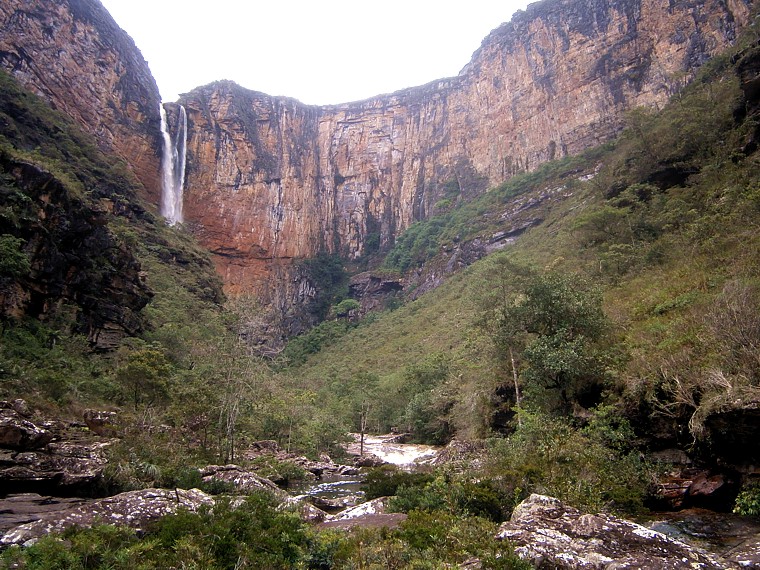
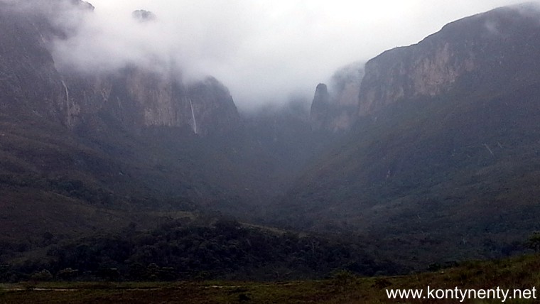
On the trail to the waterfall I set off early in the morning. In the valley between the mountains there were still clouds - it can be seen in the picture above. I passed the painted blue bakery, which was opened in the morning and marched along the gravel road first down to the wooden bridge over the river. The distance from the settlement to the gate of the nature park is only 4 km. But on the other side of the river, climbing to the green mountain begins, all the time on the red road - you do not need a guide, you can not get lost :) |
Na szlak do wodospadu wyruszyłem wcześnie rano. W dolinie między górami wisiały jeszcze chmury - widać to na zdjęciu powyżej. Minąłem otwartą od rana, pomalowaną na niebiesko piekarnię i pomaszerowałem szutrową drogą najpierw w dół - do drewnianego mostu na rzece. Z osady do bramy parku krajobrazowego są tylko 4 km. Ale po drugiej stronie rzeki zaczyna się wspinaczka na zieloną kopę, cały czas czerwoną drogą - nie trzeba przewodnika, nie da się zabłądzić :) |
|
|
|
||
|
I walked alone in the damp heat. The road was empty. But I know that you can meet the crowd on it - around Christmas and during school holidays. In the settlement you can also ask for a lift (at a charge) to the park's gate. |
Szedłem w wilgotnym upale zupełnie sam. Droga była pusta. Ale wiem, że można na niej spotkać tłum - w okolicach Świąt Bożego Narodzenia i w czasie szkolnych wakacji. W osadzie można też poprosić o podwiezienie (za opłatą) do bramy parku. |
|
|
|
||
 |
||
|
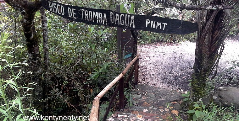
This is the gate to the landscape park where there is a waterfall. (picture below) At my sight - probably the first tourist who showed up on that day, from the administration building came a young ranger to meet me. I thought I would like to collect the payment! But no, there was no fee, and he only wanted to explain me how to visit the park. Unfortunately, he did not speak any English and did not have any maps or brochures for me. I understood from his Portuguese statement: three paths start behind the gate ... |
Tak wygląda brama do parku krajobrazowego, w którym znajduje się wodospad. (zdjęcie poniżej) Na mój widok - prawdopodobnie pierwszego turysty, jaki się tu pokazał tego dnia z budynku administracji wyszedł na spotkanie młody ranger. Myślałem, że chce zainkasować opłatę! Ale nie, opłaty nie było, a on chciał mi jedynie poradzić jak zwiedzać park. Niestety nie znał angielskiego i nie miał dla mnie żadnej mapki ani broszury. Z jego portugalskiej wypowiedzi zrozumiałem: za bramą zaczynają się trzy ścieżki... |
|
|
|
||
|
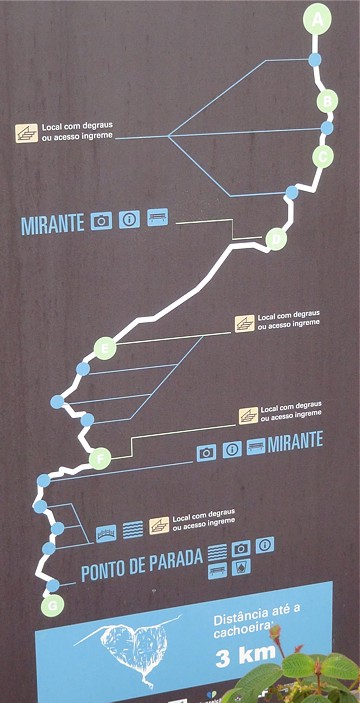
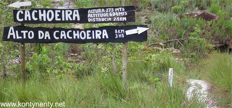
Behind the gate there was a signpost describing these paths: to the right it is a route to the summit or the waterfall threshold - 8 kilometers, three hours one way. To the left is the path to the bottom of the waterfall - only 2.5 km, but such information is misleading, especially when we hike through the mountains. The third path - the one that goes straight after about 20 minutes leads to the mirante, or view point. |
Za bramą stał drogowskaz opisujący te ścieżki: w prawo to trasa na szczyt czyli na próg wodospadu - 8 kilometrów, trzy godziny w jedną stronę. W lewo to ścieżka pod wodospad - tylko 2,5 km, ale takie informacje podane są mylące, szczególnie gdy maszerujemy przez góry. Dopiero podanie czasu marszu pozwala uwzględnić różnice wysokości. Trzecia ścieżka - ta, która idzie na wprost po około 20 minutach doprowadza na mirante, czyli punkt widokowy. |
|
 |
||
|
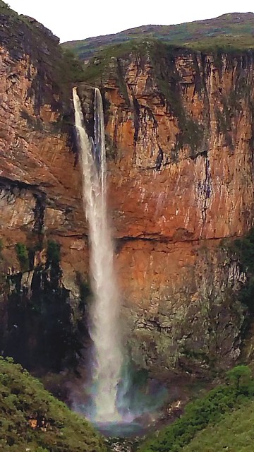
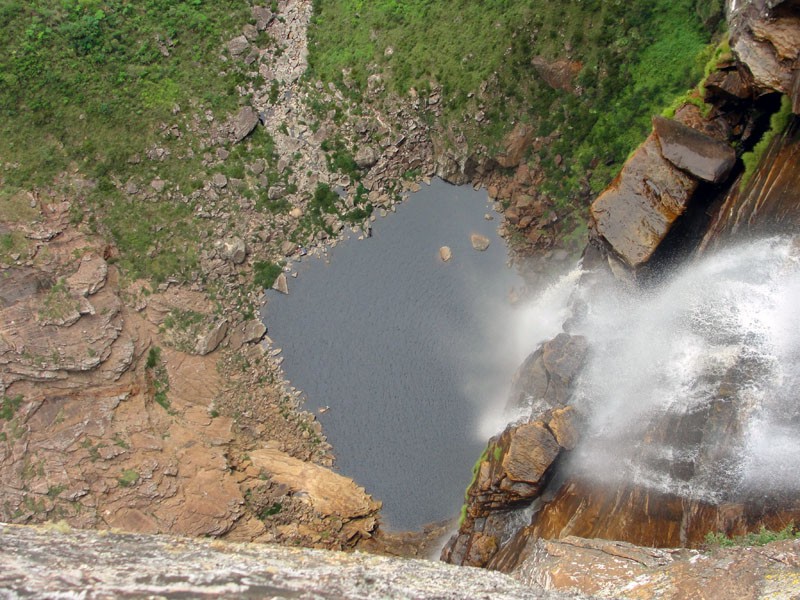
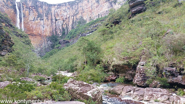
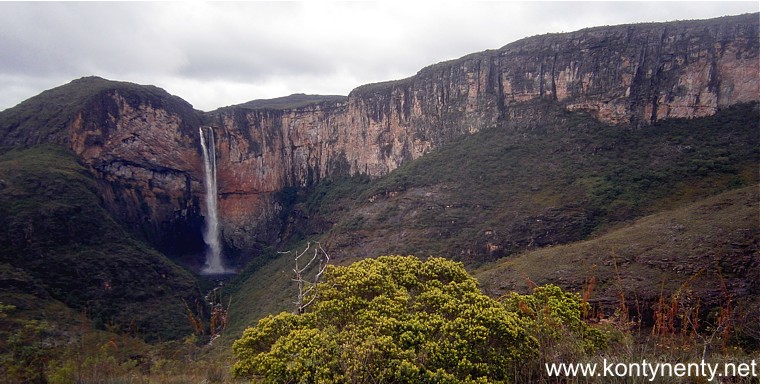
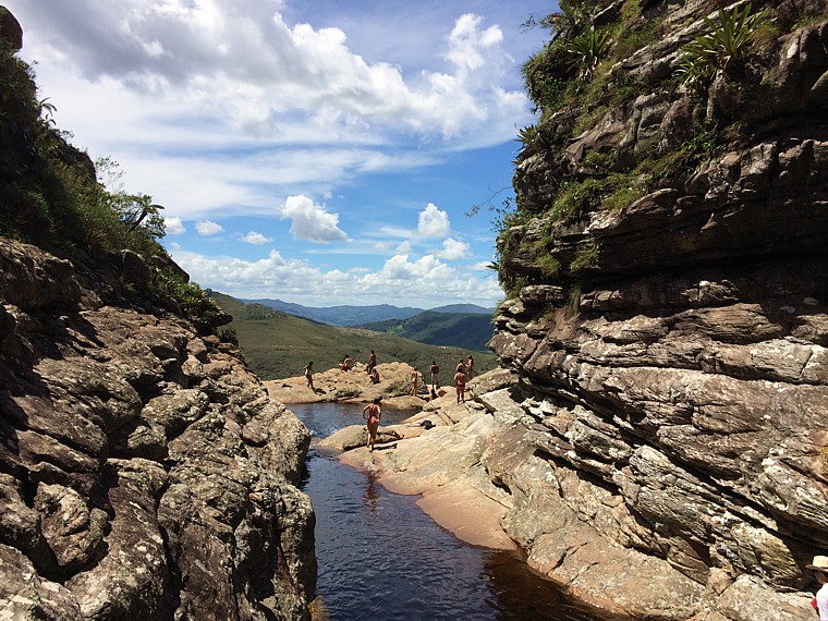
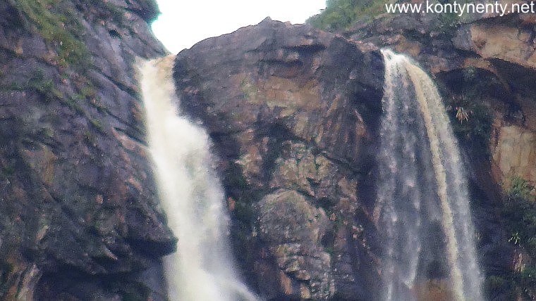
I have started my wandering around the park from this lookout point. It is located on a hill opposite the waterfall. The view that opens from here onto the rock wall and the waterfall is really great. Pay attention to the shape of this rock in the immediate vicinity of the waterfall - it is reminiscent of a heart: |
Wędrówkę po parku zacząłem właśnie od tego punktu widokowego. Zlokalizowany jest on na wzgórzu naprzeciw wodospadu. Widok, który sie stąd otwiera na skalną ścianę i wodospad jest naprawdę wspaniały. Zwróćcie przy okazji uwagę na kształt tej skały w bezpośrednim sąsiedztwie wodospadu - do złudzenia przypomina serce: |
|
 |
||
|
|
Udało się spełnić kolejne podróżnicze marzenie! Ważne, że właśnie tego dnia, kiedy wybrałem się na pieszą wędrówkę pod wodospad nie padał deszcz, a chmury podniosły się odsłaniając wierzchołki gór i cały wodospad. Widok był imponujący - ten punkt widokowy jest jedynym miejscem skąd widać całe 273 metry wodnej kaskady, łącznie z jeziorkiem pod wodospadem. W internecie znaleźć można filmy pokazujące śmiałków skaczących ze spadochronem z progu tego wodospadu.
So I managed to fulfill another traveller's dream!! It is important that just on this day when I went hiking to the waterfall there was no rain, and the clouds rose to reveal the tops of the mountains and the entire waterfall. The view was impressive - this vantage point is the only place from which you can see the whole 273 meters of the water cascade, including the little lake under the waterfall. On the internet you can find videos showing daredevils jumping with a parachute from the top. |
|
|
|
|
|
|
The park's gate closes at 17.00. From a simple calculation of time it appeared that on that day I would not be able to climb to the top of the waterfall and come back - the trail turns a large curve to reach the waterfall's top through the ridge on the right side. The next day it was raining, making it impossible for many hours of hiking ... Nothing came out of it. Still, I want to show you two photos taken by other photographers up there. The first one shows the view down from the threshold: |
Bramę parku zamykają o 17.00. Z prostej kalkulacji czasu wynikało, że tego dnia nie dam rady wejść na szczyt wodospadu i wrócić - szlak zatacza duży łuk, by dotrzeć do progu wodospadu grzbietem z prawej strony. Następnego dnia padał już deszcz uniemożliwiając wielogodzinną wędrówkę... Nic z tego nie wyszło. Mimo to chcę pokazać tu dwa zdjęcia zrobione przez innych fotografów tam, na górze. Pierwsze z nich pokazuje widok w dół z progu: |
|
|
(fot. Leo Moc) |
||
|
|
||
|
The second photo is made by the host of the Villa Tabuleiro - Ricardo Guerra and shows a rocky gate through which the water splits up there before it falls down and natural pools where you can bathe: |
Druga fotografia wykonana jest przez gospodarza Villi Tabuleiro - Ricardo Guerrę i pokazuje skalną bramę przez którą tam na górze przedziera się woda zanim runie w dół oraz naturalne baseny, w których można się tam kąpać: |
|
 |
||
|
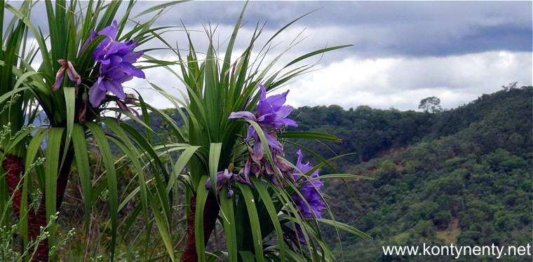
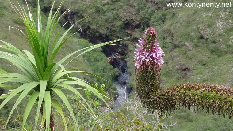
Nature is very beautiful here. At the paths and at the park's viewpoints, beautiful tropical flowers grow here, which are definitely worth paying attention to: |
Przyroda jest tu bardzo piękna. Przy ścieżkach i na punktach widokowych parku rosną tu piękne tropikalne kwiaty, na które na pewno warto zwrócić uwagę: |
|
 |
||
|
I am not a naturalist and unfortunately I can not name those flowers and shrubs. Maybe one of my readers can identify them and send me the right hint that I could put here? |
Nie jestem przyrodnikiem i nie potrafię niestety nazwać tych kwiatów i krzewów. Może ktoś z moich czytelników potrafi je zidentyfikować i przysłać mi właściwą podpowiedź, którą mógłbym tu zamieścić? |
|
|
|
||
|
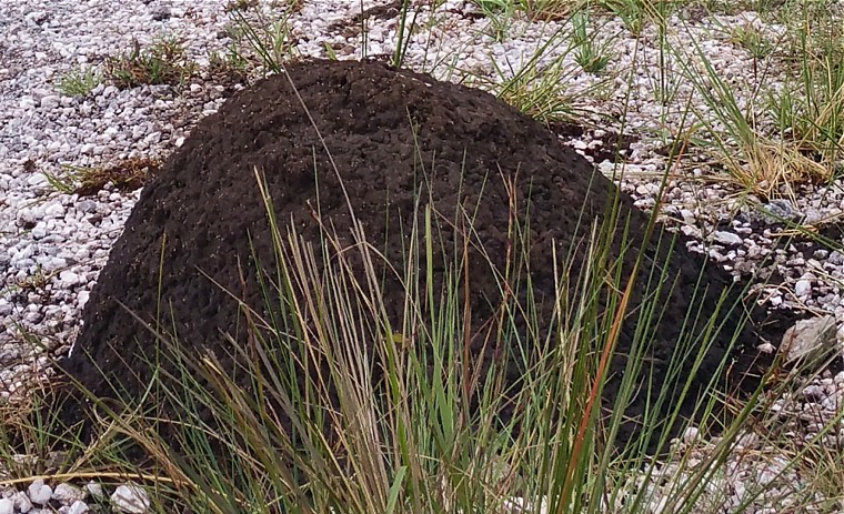
On the route I also saw interesting, black termite mounds. But their height did not exceed half a meter: |
Na trasie widziałem także ciekawe, czarne termitiery. Ale ich wysokość nie przekraczała pół metra: |
|
 |
||
|
|
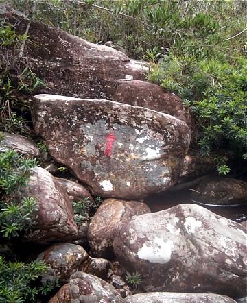
Po powrocie z punktu widokowego do bramy parku postanowiłem podjąć próbę dotarcia "lewą" ścieżką pod wodospad - to nie wymagało tyle czasu, co wędrówka na szczyt wodospadu. Parkowe ścieżki są dobrze oznakowane tablicami takimi, jak ta obok. Niestety opisy na tablicach są tylko w języku portugalskim - to widomy znak, że dociera tu na razie bardzo mało zagranicznych turystów.
After returning from the viewpoint to the park gate, I decided to try to reach the waterfall by the left path - it did not take so much time to go to the top of the waterfall. Park paths are well marked with signs such as the one next to it. Unfortunately, the descriptions on the boards are only in Portuguese - it is a visible sign that very few foreign tourists are coming here. |
|
|
The first part of this route under the waterfall is very well maintained: there are sections of the barriers and stairs. On the picture below you can see how the trail runs towards the river. Down it goes lightly, with beautiful views of the waterfall, only on the way back this episode turns into a real wall of sweat: |
Pierwsza część tej trasy prowadzącej pod wodospad jest bardzo dobrze utrzymana: są tu odcinki barierek i schodów. Na zdjęciu poniżej widać jak szlak zbiega ku rzece. W dół idzie się lekko, z pięknymi widokami na wodospad, dopiero w drodze powrotnej ten odcinek przeradza się w prawdziwą ścianę potu: |
|
 |
||
|
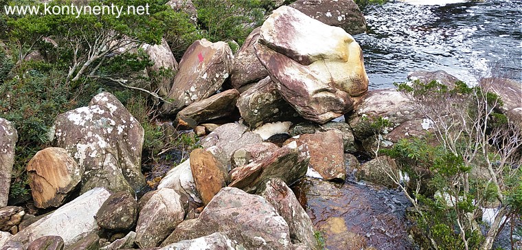
It's only when you get to the river flowing in the ravine the situation will change dramatically. First, you read the warning about the threat of a water whirlwind: |
Dopiero gdy dotrzecie do płynącej w wąwozie rzeki sytuacja zmieni się dramatycznie. Najpierw przeczytacie ostrzeżenie o zagrożeniu trąbą wodną: |
|
 |
||
|
|
Potem dobra dotąd ścieżka skończy
się nagle nad bocznym potokiem, a wypłowiałe czerwone strzałki pokażą, że
dalej trzeba iść po wielkich głazach. A to już wymaga większej sprawności
fizycznej. Widzicie tę strzałkę na zdjęciu poniżej? To tamtędy trzeba
przejść!
Then the good path will end suddenly over a side stream, and the faded red arrows will show that you have to go on large boulders. And that requires more physical fitness. Can you see the arrow in the picture below? |
|
 |
||
|
Finally, the arrows showed the direction to the other side of the stony riverbed. And here I had to think about it. I looked at the high water level after yesterday's rain and the slippery wet stones that I had to be jumped on to the other side. I decided that the risk is too high, the way back is steep, and around I cannot see single person who could, for example, help or call for help even if the leg is just dislocated ... |
Wreszcie strzałki pokazały kierunek na drugą stronę kamienistego koryta rzeki. I tu musiałem się zastanowić. Popatrzyłem na wysoki po wczorajszym deszczu stan wody i na śliskie, mokre kamienie po których trzeba było przeskoczyć na drugą stronę. Uznałem, że ryzyko jest zbyt duże, droga powrotna stroma, a w polu widzenia ani jednego człowieka, który mógłby na przykład pomóc czy wezwać pomoc choćby w przypadku zwykłego zwichnięcia nogi... |
|
 |
||
|
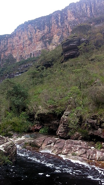
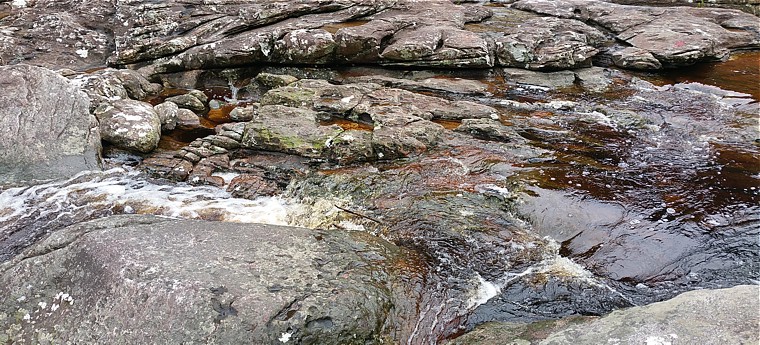
The river flowing down from the lake under the waterfall flowed rapidly, foaming on the rocks. Interestingly, the color of the water in the river was brown - it is supposedly the effect of the decomposition of plants in the area through which water flows: |
Rzeka wypływająca z jeziorka pod wodospadem płynęła wartko, pieniąc się na skałkach. Ciekawe, że kolor wody w rzece był brunatny - to podobno efekt rozkładu roślin na terenie przez który przepływa woda: |
|
 |
||
|
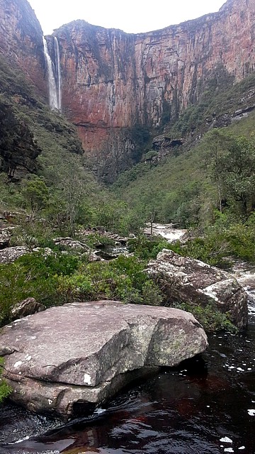
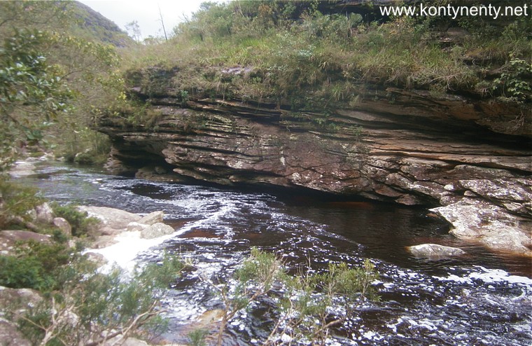
From the end point of my walk, I could look up a gorge, towards a waterfall. As I learned later, the route up there once more crosses the river. Maybe one day the park authorities will build some small bridges here, so that crossing during the high water would not be a hindrance? |
Z punktu krańcowego mojej wędrówki mogłem sobie popatrzeć w górę wąwozu, ku wodospadowi. Jak się później dowiedziałem szlak tam wyżej raz jeszcze przekracza rzekę. Może kiedyś władze parku wybudują tu jakieś małe mostki, aby przy wysokiej wodzie przeprawa nie była przeszkodą? |
|
|
|
||
| Before I turned back I made a few photos, immortalizing, among others, this high stone wall of nearly 300 meters: |
Zanim zawróciłem zrobiłem jeszcze kilka zdjęć, uwieczniając między innymi tę wysoką na blisko 300 metrów skalną ścianę: |
|
|
|
|
|
|
|
||
|
It was the same waterfall, but viewed from a completely different perspective than the viewpoint, which is why I think it was worth coming to this place anyway. |
To był ten sam wodospad, ale oglądany zupełnie z innej perspektywy niż ta na punkcie widokowym i dlatego uważam, że mimo wszystko warto było do tego miejsca dotrzeć. |
|
|
|
|
|
|
|
||
|
|
||
|
Using the maximum zoom of my camera, I tried to photograph the waterfall threshold itself. Unfortunately, the video camera does not give you the opportunity to focus accurately at such a large distance from the object. Please, forgive me for the imperfection of this photo: |
Wykorzystując maksymalne zbliżenie mojej kamery spróbowałem fotografować sam próg wodospadu. Niestety kamera video nie daje możliwości dokładnego ustawienia ostrości przy tak dużej odległości od obiektu. Proszę zatem wybaczyć mi niedoskonałość tego zdjęcia: |
|
 |
||
|
I returned to the Tabuleiro settlement late in the afternoon, tired, but happy ... I was surprised to find that despite the cap I wear, I have strongly reddened ears and the tip of my nose. The sun operates here very strongly! |
Do osady Tabuleiro wróciłem późnym popołudniem, zmęczony, ale szczęśliwy... Ze zdumieniem stwierdziłem, że mimo noszonej czapki mam silnie zaczerwienione uszy i czubek nosa. Słońce operuje tu bardzo silnie! |
|
|
Cachoeira de Tabuleiro is undoubtedly the biggest attraction of this region, but it is worth knowing that at a short distance from this waterfall you can also find other landscape attractions that may be the goal of next hiking ... The next day of my stay it was raining, but there were also periods of sun... My host offered me a ride in his car to a nearby canyon. - It's only 10 kilometers on the country road! |
Cachoeira de Tabuleiro jest niewątpliwie największą atrakcją tego regionu, ale warto wiedzieć, że w niewielkiej odległości od tego wodospadu można znaleźć także inne atrakcje krajobrazowe, które mogą być celem kolejnych pieszych wycieczek... Następnego dnia mojego pobytu padał deszcz, ale były też okresy przejaśnień... Mój host sam zaproponował mi przejażdżkę swoim samochodem do pobliskiego kanionu. - To tylko 10 kilometrów terenową drogą! |
|
 |
||
|
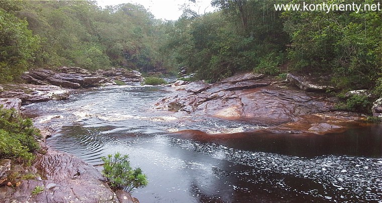
We were going on the red roads in the pasture an forestal landscape, passing lonely fazendas and enjoying the views. We came close to the Peixe Tolo Canyon. The picture below is taken from the trailhead. From this place path go to the canyon entrance, from the entrance you can walk up 1 hour to the second high waterfall of Minas Gerais and another 1 hour to the end of the canyon where another, much lower fall can be seen: |
Jechaliśmy czerwonymi, wyboistymi drogami w krajobrazie pastwisk i lasów, mijając samotne gospodarstwa - hacjendy i ciesząc oczy widokami. Dojechaliśmy na początek szlaku prowadzącego do wnętrza kanionu. Zdjęcie poniżej pokazuje wejście do kanionu ze skalną basztą po prawej i wodospadami po lewej. Od bramy kanionu godzina marszu doprowadza do drugiego najwyższego wodospadu stanu Minas Gerais, a kolejna godzina - do końca kanionu z kolejnym, niższym wodospadem |
|
 |
||
|
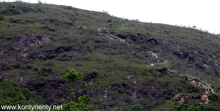
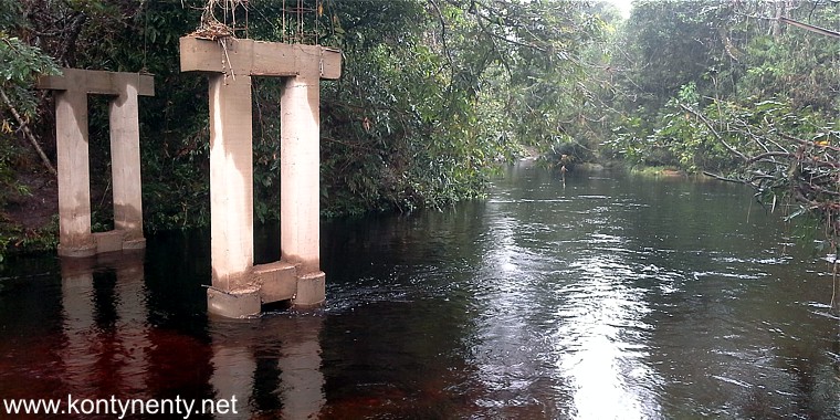
Then my host wanted to show me another waterfall - Rabo de Cavalo (Horse Tail). However, we were unlucky. After driving a few kilometers, a large, swollen river blocked us. I saw the locals fording here - they know shallow places. But for our 2WD car it was an insurmountable obstacle. Once a bridge construction was started here (photo below) - maybe one day it will be built here, opening the way to the picturesque place. |
Potem mój host chciał mi pokazać kolejny wodospad - Rabo de Cavalo (Koński Ogon). Mieliśmy jednak pecha. Po przejechaniu kilku kilometrów zagrodziła nam drogę spora, wezbrana rzeka. Widziałem, jak miejscowi pokonywali ją w bród - oni znają płytkie miejsca. Ale dla naszego samochodu 2WD była to przeszkoda nie do pokonania. Kiedyś rozpoczęto tu budowę mostu (zdjęcie poniżej) Być może kiedyś most powstanie, otwierając drogę do malowniczego miejsca, póki co osiągalnego tylko piechotą. |
|
 |
||
|
|
||
|
Same situation was in the afternoon, when I tried to walk to Congonhas waterfall - 4 kms up and down from Tabuleiro (last 3 kms by walk only)... Bad luck! But I still saw a lot! Just let you know that the driest season here is from May to August - nobody told me that! :) |
Sytuacja powtórzyła się, gdy po południu podjechaliśmy do miejsca (1 km od osady Tabuleiro) gdzie zaczyna się 3-kilometrowy szlak pieszy do wodospadu Congonhas - tu znowu utknęliśmy w miejscu, gdzie turyści przechodzą w bród górską rzekę. W porze suchej, która trwa tu od Maja do sierpnia nie powinno być z tym problemów - wcześniej o tym nie wiedziałem :) |
|
 |
||
|
Half an hour's walk from the Tabuleiro estate leads to a small lagoon (backwaters on the river) which they call Poco Pari. Below the small cascade you can swim there. But this is a private property, where they charge an entrance fee... |
Pół godziny marszu z osiedla Tabuleiro doprowadza do małej laguny (rozlewiska na rzece) którą nazywają Poco Pari. Poniżej niewielkiej kaskady można tam popływać. Ale jest to prywatna własność, gdzie pobierają opłatę za wstęp... |
|
|
|
I to już chyba wszystko, co chciałem przekazać miłośnikom przyrody i podróżnikom, szukającym pięknych i rzadko odwiedzanych miejsc. Mam nadzieję, że moje doświadczenia opisane na tej stronie ułatwią wam zaplanowanie podróży to tego ciekawego i mało znanego zakątka naszego globu... Udanej podróży i wspaniałych wrażeń!
And that's probably all that I wanted to convey to nature lovers and travelers looking for beautiful and rarely visited places. I hope that my experiences described on this page will help you plan your trip to this interesting and little-known corner of our globe... Have a great trip and great experience! |
|
|
It is worth mentioning at the end that Villa Tabuleiro offers a reasonable price for transfers by car from Belo Horizonte to Tabuleiro. It is especially cost-effective and convenient when traveling in a small group. |
Warto na zakończenie jeszcze wspomnieć, że Villa Tabuleiro oferuje za rozsądną cenę transfery samochodem z lotniska Belo Horizonte do Tabuleiro. Jest to szczególnie opłacalne i wygodne, gdy podróżuje się w małej grupie. |
|
|
My hot news from this expedition (in English) you can read in my travel log: www.globosapiens.net/travellog/wojtekd
|
Notatki robione "na gorąco" na trasie podróży (po angielsku) można przeczytać w moim dzienniku podróży w serwisie globosapiens.net |
|
Przejście do strony "Moje podróże" Back to main travel page
Powrót do głównego katalogu Back to the main directory
![]()